Source Water Vulnerability Assessment
Across Four South African Provinces
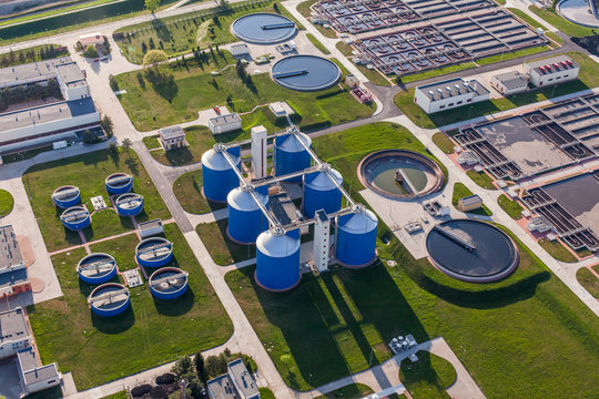
WATER SECURITY IS NO LONGER JUST ABOUT VOLUME
South Africa's industrial water landscape is defined by increasing climate variability, aging municipal infrastructure, and a steady decline in Blue Drop quality standards. For any large-scale manufacturer operating across multiple provinces, the risk profile is not uniform — it is site-specific, geology-driven, and compounded by the cumulative failures of the municipal systems they depend on.
The client — a major industrial manufacturer with production facilities across four provinces — engaged Hinc Group to answer a question that standard environmental audits cannot: not just whether their water sources are currently safe, but whether they will remain viable, legally defensible, and operationally resilient over the next decade.
The engagement was structured to deliver a Dual-Purpose Instrument: ensuring operational business continuity against immediate threats while establishing the hydrogeological baseline required for Water Use Licence (WULA) compliance and National Water Act Section 19 liability defence.
Evaluate the long-term failure probability of municipal supply infrastructure — moving beyond standard reporting to model outage risk against historical interruption trends and Blue Drop performance decline.
Identify and rank feasible alternative or supplementary water sources — groundwater, surface water, and effluent reuse — by yield, quality, CAPEX, and Levelised Cost of Water.
Delineate legally defensible Source Water Protection Zones (Zones 1, 2, and 3) using geology-specific models adapted to each site's hydrogeological character.
Compile a comprehensive Threat Inventory Register categorised by Time-to-Impact, using the Source-Pathway-Receptor model to identify contamination pathways that threaten production quality.
Deliver not just a report, but a CAPEX-informed decision-support tool — integrated directly into the client's Water Safety Planning framework to guide long-term capital investment strategy.
A PHASED, FORENSIC APPROACH
The 16-week programme is structured to ensure that every deliverable is grounded in verified empirical data — not desktop assumptions. Critical buffers are built in for laboratory turnaround times and municipal data acquisition, because defensible data takes longer than fast data.
Inception & Secondary Data Review
Comprehensive desktop review of municipal supply sources, Blue Drop and Green Drop performance trends, DWS borehole databases, aquifer classifications, land-use zoning, agricultural activity, historical rainfall records, and population growth projections across all four provincial sites.
Field Investigations & Primary Data Collection
Forensic hydrocensus tailored to each site's specific risk profile — physical inspection of municipal abstraction points and reservoir infrastructure, site-specific contamination pathway mapping, stakeholder interviews with municipal engineers, water boards, and local officials to validate on-the-ground reliability versus reported statistics.
Source Water Delineation & GIS Analysis
GIS-based mapping of Zones 1, 2, and 3 (Immediate Protection, Microbial Capture, and Catchment Zones) using site-specific geological models. Karst-specific vulnerability mapping for Tlokwe, fracture-flow analysis for Phelindaba, and hydrological catchment boundary delineation for Butterworth and Isithebe.
Threat Inventory, Risk Characterisation & Vulnerability Assessment
Compilation of a forensic Threat Inventory Register using the Source-Pathway-Receptor model. DRASTIC Index applied to groundwater-dependent sites; runoff potential modelling for surface water catchments. Risk Hotspot Maps produced by overlaying the Threat Inventory onto Vulnerability Layers, identifying Critical Control Points for targeted intervention.
Reporting, Review & Handover
Consolidation of all findings into a Final Consolidated Report and Water Security Matrix — a CAPEX-informed decision-support tool ranking each alternative source by implementation cost and Levelised Cost of Water (Rand/m³). Findings are integrated directly into the client's Water Safety Planning framework.
THE SCIENCE BEHIND THE WORK
The DRASTIC Model
The DRASTIC Index scores aquifer sensitivity across seven parameters: Depth to Water, Recharge, Aquifer Media, Soil Media, Topography, Impact of Vadose Zone, and Conductivity. For karst geology, the model is adapted to account for rapid contaminant transport via sinkholes — where standard porous-media assumptions dramatically underestimate risk.
Source-Pathway-Receptor Model
Every identified threat is evaluated across three dimensions: the Source (point vs. diffuse), the Pathway (how effectively the geology transmits the pollutant — rapid via Tlokwe's sinkholes vs. slow attenuation in clay soils), and the Receptor (the specific vulnerability of the facility's intake borehole or river pump). This produces a Time-to-Impact ranking for Early Warning System design.
GIS Risk Hotspot Mapping
The Threat Inventory is overlaid onto the Vulnerability Layers to produce Risk Hotspot Maps — spatial outputs that identify Critical Control Points where targeted interventions (land-use buffers, monitoring wells, early warning triggers) are required. These maps are legally defensible, GIS-packaged, and designed to stand up to DWS and Green Scorpion scrutiny.
A VULNERABILITY ASSESSMENT THAT REMAINS RELEVANT IN THE FUTURE
A source water assessment is only valuable if it accounts for the conditions that will define water security over the next 10 to 20 years — not just the conditions that exist today. Hinc Group explicitly stress-tests each supply system against three future scenarios that are already reshaping South Africa's water landscape.
Modelling the impact of increased evaporation and lower rainfall on dam levels in the Eastern Cape and aquifer recharge in the North West. Assessing increased contaminant mobilisation during high-intensity KZN storm events — a risk that is growing, not shrinking.
Reviewing municipal Spatial Development Frameworks to model the pollution load from planned housing developments, quantifying the risk of un-serviced settlement growth upstream of surface water intakes — and factoring this into the 10-year vulnerability projection.
Factoring in the cumulative impact of planned industrial expansion adjacent to each site — ensuring the client anticipates future competition for groundwater yield and increased chemical loading risks before they materialise as operational crises.
NOT JUST A REPORT — A DECISION-SUPPORT TOOL
Risk Hotspot Maps
GIS-based overlay of threat inventory and vulnerability layers, identifying Critical Control Points where specific interventions — land-use buffers, monitoring wells, early warning systems — are required to protect each facility's supply.
Water Security Matrix
A ranked comparison of all alternative and supplementary water sources by implementation CAPEX and Levelised Cost of Water (Rand/m³), enabling direct, evidence-based capital investment decisions.
Source Water Protection Zones
Legally defensible Zone 1, 2, and 3 delineations using site-specific geological models — providing the hydrogeological baseline required for Water Use Licence (WULA) compliance and NWA Section 19 liability defence.
WSP Integration Pack
Findings are directly integrated into the client's Water Safety Planning framework — not a standalone report, but a living operational tool that guides long-term capital investment and regulatory compliance strategy.
FIELD-TO-BOARDROOM CAPABILITY
Hinc Group assembled a specialist team of SACNASP and EAPASA registered professionals with over 60 years of combined experience in water resource management, toxicology, and spatial analysis across Southern Africa — combining forensic field investigation with high-level strategic reporting.
Senior Hydrologist & Project Lead
Specialist in catchment hydrology and yield analysis for industrial water users. Background in water balance modelling (HEC/SWMM) — stress-tests municipal supply resilience against drought and operational failure. Has led large-scale bulk water master plans exceeding R100 million.
Environmental Scientist & Toxicologist
Specialist in toxicology and contaminant behaviour. Applies the Source-Pathway-Receptor model to characterise complex industrial risks. ISO systems auditing experience ensures recommendations integrate into existing environmental management systems.
Field Environmental Scientist
Forensic hydrocensus and site verification specialist. Moves beyond desktop data to physically verify contamination sources, identify sanitation risks, and confirm borehole usage patterns in the field.
GIS & Spatial Analyst
Specialises in sensitivity mapping and spatial overlay analysis. Responsible for digitising Source Water Protection Zones and creating the Risk Hotspot Maps required for long-term planning and regulatory defensibility.
SKILLS TRANSFER & CAPACITY BUILDING
This engagement was structured as a live training ground. A Junior Environmental Analyst worked directly alongside the Senior GIS Specialist, gaining advanced skills in Spatial Vulnerability Mapping. Junior Field Technicians were deployed with the Senior Hydrogeologist to execute the Forensic Hydrocensus, gaining practical competence in SANS 5667 sampling methodology and stakeholder negotiation — meaningful experience, not administrative exposure.
LOCAL PROCUREMENT & SUPPLY CHAIN
To ensure economic benefits remained within the target provinces, SANAS-accredited laboratories located within each specific province were utilised — including East London for Butterworth samples — reducing logistics costs and supporting regional business. Where supplementary services were required, preference was given to Exempted Micro Enterprises (EMEs) and QSEs from the local communities of Tlokwe, Butterworth, and Isithebe.
IS YOUR WATER SUPPLY RESILIENT ENOUGH TO WITHSTAND THE NEXT DECADE?
South Africa's water risk landscape is not improving. If your operations depend on municipal supply across multiple provinces, a Source Water Vulnerability Assessment is not a compliance exercise — it is a capital protection strategy. Commission a forensic assessment that delivers defensible data, not just a fast report.